Himalayan Settlement & Infrastructure Vulnerability Watch: Identifying Risks Before Disasters Strike

Across Himachal Pradesh, hillside excavation near settlements and construction close to mountain streams are raising important questions about environmental vulnerability and infrastructure safety. Through our Himalayan Settlement & Infrastructure Vulnerability Watch, we are documenting potentially vulnerable locations and seeking scientific assessment and preventive action before disasters occur.
Why We Started the Himalayan Vulnerability Watch
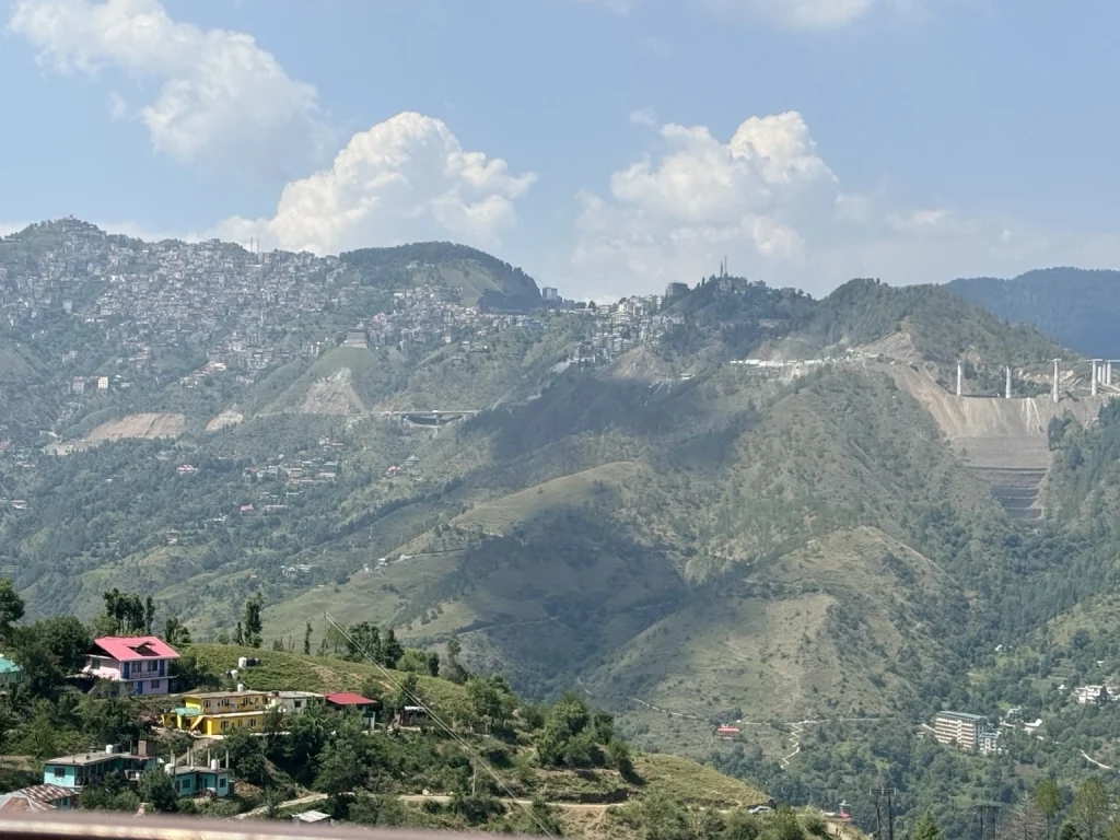
The Himalayan landscape is characterised by steep slopes, narrow valleys, seasonal streams and complex geological conditions. Intense rainfall and natural erosion processes make careful planning essential for settlements, roads and other infrastructure.
Increasing urbanisation, highway construction, hillside excavation and development near natural drainage channels can add to these existing vulnerabilities. The effects of such interventions need to be understood through geological, hydrological and engineering assessments.
We have initiated this citizen-led programme under Himalayan Impact Watch to document potential concerns, bring them to the attention of responsible authorities and encourage preventive examination.
Our approach is guided by three principles: identify early, assess scientifically and act before disaster.
Two locations documented in Shimla and Mandi districts illustrate different aspects of this work.
Case 1: Bhattakufer, Shimla – Hillside Excavation and Residential Vulnerability
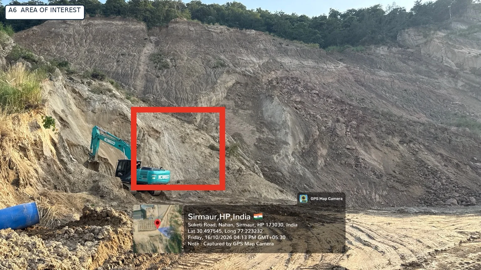
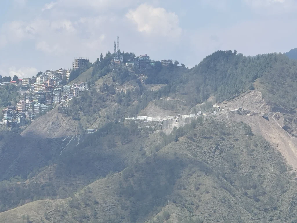
Our first case concerns extensive hillside excavation associated with highway development in the Sanjauli-Bhattakufer sector of Shimla, including areas where residential settlements are situated above or near disturbed mountain slopes.
The documentation also covers concerns along the Shimla bypass corridor towards Mehli, Beolia and Shoghi.
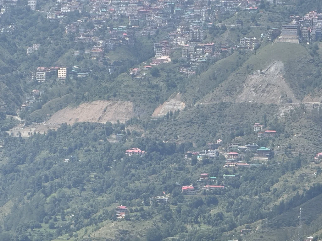
Photographs assembled for this case show exposed hillside surfaces, extensive earth cutting, road construction infrastructure and residential development across the surrounding mountain terrain.
Why the Excavation Requires Technical Attention
Cutting into a mountain slope can change its natural support conditions, drainage patterns and erosion behaviour. Where substantial excavation takes place near occupied settlements, these changes require careful technical evaluation.
Our principal concerns include the potential instability of deeply excavated slopes during intense or prolonged rainfall, possible effects on nearby buildings and infrastructure, and the adequacy of slope stabilisation measures.
The condition of retaining structures, surface drainage, erosion protection and arrangements for controlling rockfall or debris movement also require examination.
The photographs provide visual evidence of the scale and surrounding context of hillside disturbances. However, they cannot independently establish the stability of a slope or the structural safety of individual buildings.
Representation to the District Administration
On 21 June 2026, we forwarded a representation to the Deputy Commissioner, Shimla, requesting preventive examination of the concerns.
According to the subsequent administrative communication described in our case record, the matter was referred to the National Highways Authority of India (NHAI), with an investigation to be undertaken.
We continue to seek written technical findings, information about inspections carried out and details of any corrective measures considered necessary.
Ten photographs were compiled into a reconstructed photographic evidence annexure in October 2026. The exact locations and assignments of individual photographs to the complaint’s two sub-sites remain subject to verification.
Current status: The concern has been formally raised with the district administration. Written technical assessment findings and action-taken details remain awaited.
Case 2: Karsog, Mandi – Construction Near a Mountain Stream
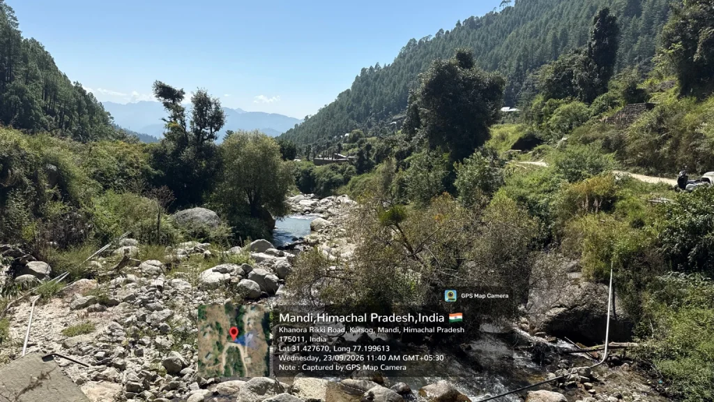
Our second case concerns a mountain stream corridor in the Khanora-Rikki Road area of Karsog, District Mandi.
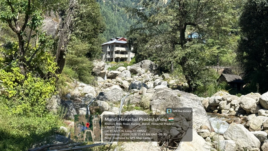
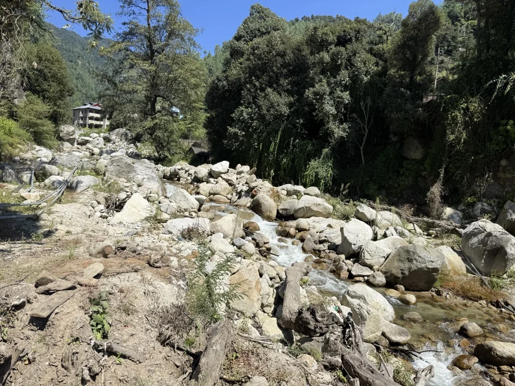
During field documentation conducted on 23 September 2026, we recorded a multistorey building situated near a narrow stream containing large boulders and coarse channel deposits.
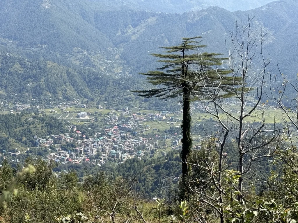
The photographs show flowing water, a boulder-rich drainage channel, nearby road infrastructure and development adjoining the mountain landscape.
Understanding the Potential Stream Corridor Risks
Mountain streams can behave very differently during normal conditions and periods of exceptional rainfall. Increased water flow, sediment transport and movement of large boulders can create conditions that require careful consideration when structures are located nearby.
At the documented location, the relationship between the building and the stream needs independent examination. The available photographs do not establish the building’s foundation level, its measured distance from the active channel or its exposure to flooding.
Several questions require investigation, including whether the structure lies within an active or historically affected drainage corridor, whether sufficient setbacks have been maintained and whether its foundations and surrounding protective works are appropriate for the site conditions.
The possibility of flash floods, debris flows, streambank erosion and channel obstruction also requires technical evaluation.
The Need for a Coordinated Field Assessment
We consider this location suitable for a coordinated examination by the district administration and relevant engineering, revenue, town planning and disaster management authorities.
A technical investigation should establish the actual stream alignment, upstream catchment conditions, potential flood and debris-flow exposure, building setbacks and any measures needed to reduce identified risks.
The photographic evidence includes geotagged field images and contextual map screenshots showing the observed location south of the Raigarh Pass area. However, these maps do not independently verify the stream’s complete course or its hydrological connection with settlements around Karsog.
Current status: A preliminary field concern has been documented. Formal technical findings are not yet available.
What the Two Cases Demonstrate
Although the Shimla and Karsog cases involve different settings, they illustrate a shared challenge in Himalayan development: the need to understand natural terrain and drainage conditions before infrastructure and settlements become exposed to preventable risks.
In Shimla, the concern relates to extensive hillside excavation and its possible implications for nearby residential areas. In Karsog, the concern involves the relationship between a building and the natural behaviour of a mountain stream corridor.
Both cases highlight the importance of credible geological, hydrological and engineering assessments.
Photographic documentation provides a useful starting point for identifying concerns and requesting further examination. It does not replace the technical investigations required to determine actual hazards, building safety or compliance with applicable construction requirements.
Our Appeal to Government Authorities
We urge district administrations, highway and public works agencies, town planning departments and disaster management institutions to strengthen preventive monitoring of potentially vulnerable settlements and infrastructure.
Through this initiative, we seek:
- Timely technical inspections wherever credible environmental or infrastructure safety concerns are reported.
- Written communication of inspection findings and action taken by responsible authorities.
- Transparent access to relevant slope stability, drainage and construction safety records.
- Appropriate preventive engineering measures wherever risks are scientifically established.
- Greater public participation in identifying and reporting potential environmental vulnerabilities.
Preventive assessment and transparent communication can help authorities and communities make better-informed decisions about development in sensitive mountain terrain.
Inviting Citizens to Participate in Preventive Monitoring
We invite residents of Himachal Pradesh to report locations where houses, schools, hospitals, roads or other public infrastructure may be exposed to slope excavation, landslides, erosion, flash floods or disturbed natural drainage.
Reports should preferably include photographs, an approximate location, the date of observation and a brief description of the concern.
Every submission will be subject to preliminary scrutiny. Where warranted, we may refer documented concerns to the competent authorities for further technical assessment.
Our Himalayan Settlement & Infrastructure Vulnerability Watch is intended to support prevention through responsible observation, scientific investigation and cooperation with public institutions.
Public disclosure: The cases presented here are based on preliminary citizen observations and photographic documentation. They do not establish that any identified building is structurally unsafe, that any construction is unlawful or that administrative negligence has occurred. Such conclusions require appropriate technical and documentary evidence.
By identifying concerns early and seeking timely assessment, we aim to contribute to safer settlements and more environmentally responsible development across Himachal Pradesh.
Related Articles
More stories and updates worth exploring from our journey.