Satellite Imagery and Photographs Raise Concerns Over Forest Cover Loss in Himachal Pradesh

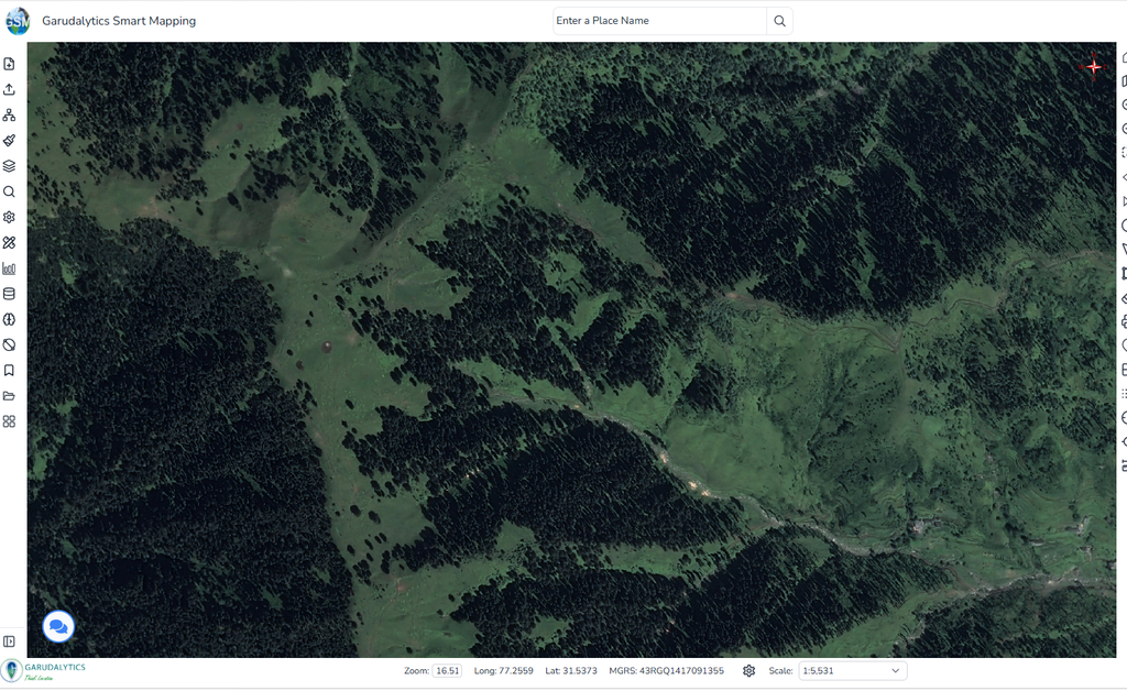
A comparison of satellite imagery from 2015, 2017 and 2026 indicates expanding areas of disturbed land and reduced vegetation cover in a forested region of Himachal Pradesh. An assessment of these changes, together with photographs showing cut timber and wood accumulation, highlights concerns about possible logging activity and its impact on the local forest landscape.
Satellite Imagery Reveals Changes Between 2015 and 2026
The assessment, titled “Assessment of Logging Activity and Forest Cover Change in Himachal Pradesh Using Multi-Temporal Satellite Imagery (2015-2026)“, examines changes within a defined geographical area.
The study covers latitudes 31.520705° N to 31.539369° N and longitudes 77.251116° E to 77.287574° E.
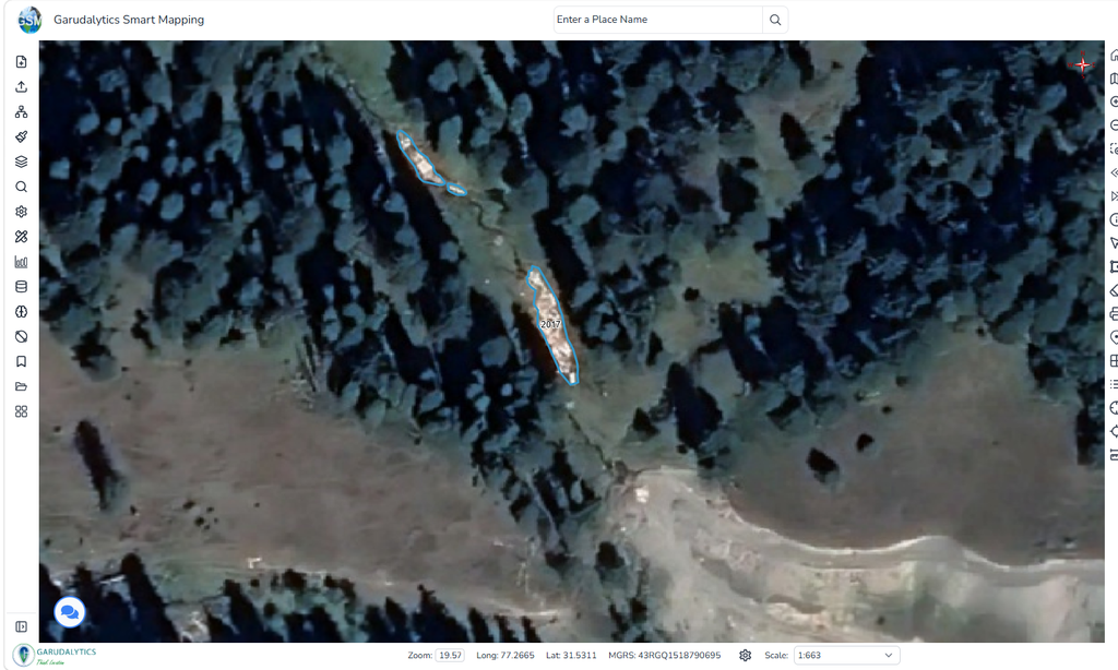
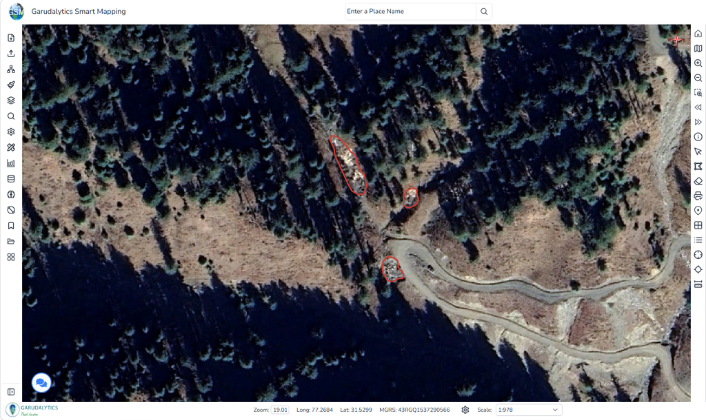
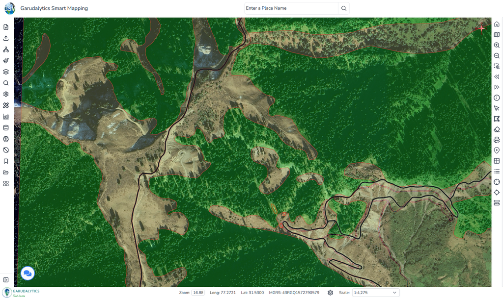
According to the assessment, no evidence of logging activity was identified in the 2015 satellite imagery. However, the analysis of 2017 imagery identified locations showing signs of possible logging activity. These locations were marked using mapped polygons to illustrate the areas of concern.
By 2026, the assessment reported a noticeable expansion of the identified disturbed areas compared with 2017, suggesting further vegetation removal within the region.
Comparison of Vegetation Cover in 2017 and 2026
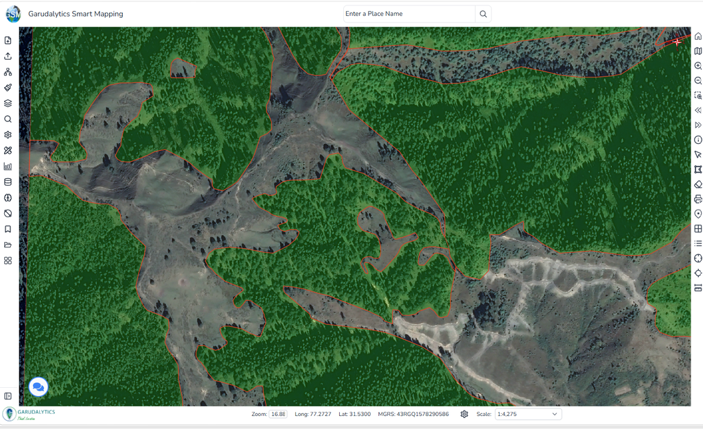
A broader comparison of satellite imagery from 2017 and 2026 reveals further changes in the forest landscape.
The assessment identifies areas that appeared densely vegetated in earlier imagery but were visibly more exposed or sparsely vegetated in the 2026 comparison. It also describes an increase in barren ground and a reduction in tree cover across parts of the study area.
These observations suggest that changes have occurred in the distribution of vegetation and exposed land. However, the assessment does not provide a quantified measurement of the total forest area affected.
Photographs Document Cut Timber and Forest Drainage Areas
In addition to the satellite assessment, the supplied photographic material shows cut tree trunks, timber pieces and accumulated wood within forested surroundings.
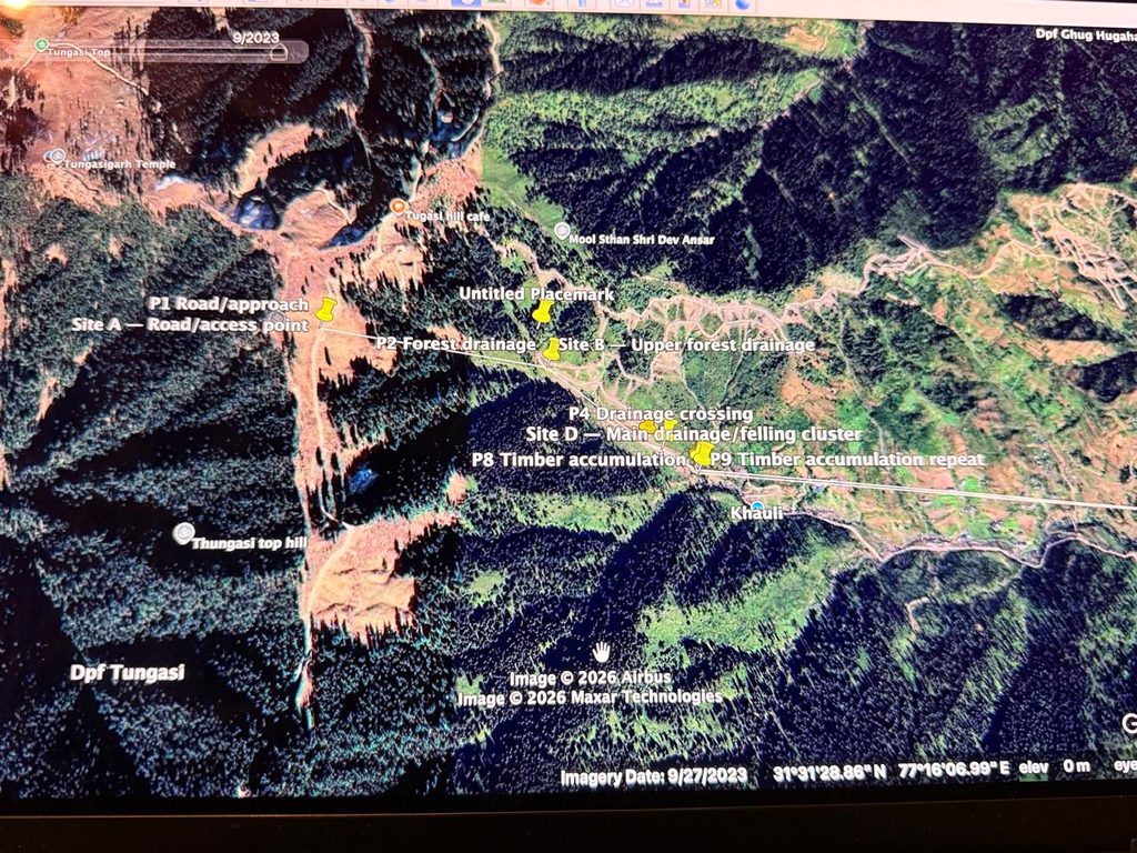
An annotated satellite view containing imagery dated 27 September 2023 identifies several locations described as road access points, forest drainage areas, a drainage crossing and timber accumulation sites.
The marked locations provide geographical context for the photographed material, although the annotations alone do not establish when or how the timber accumulated.
Cut Logs Within Drainage Channels
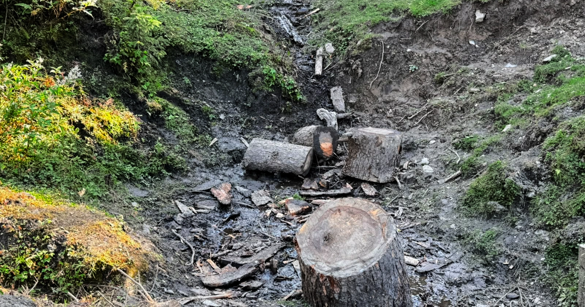
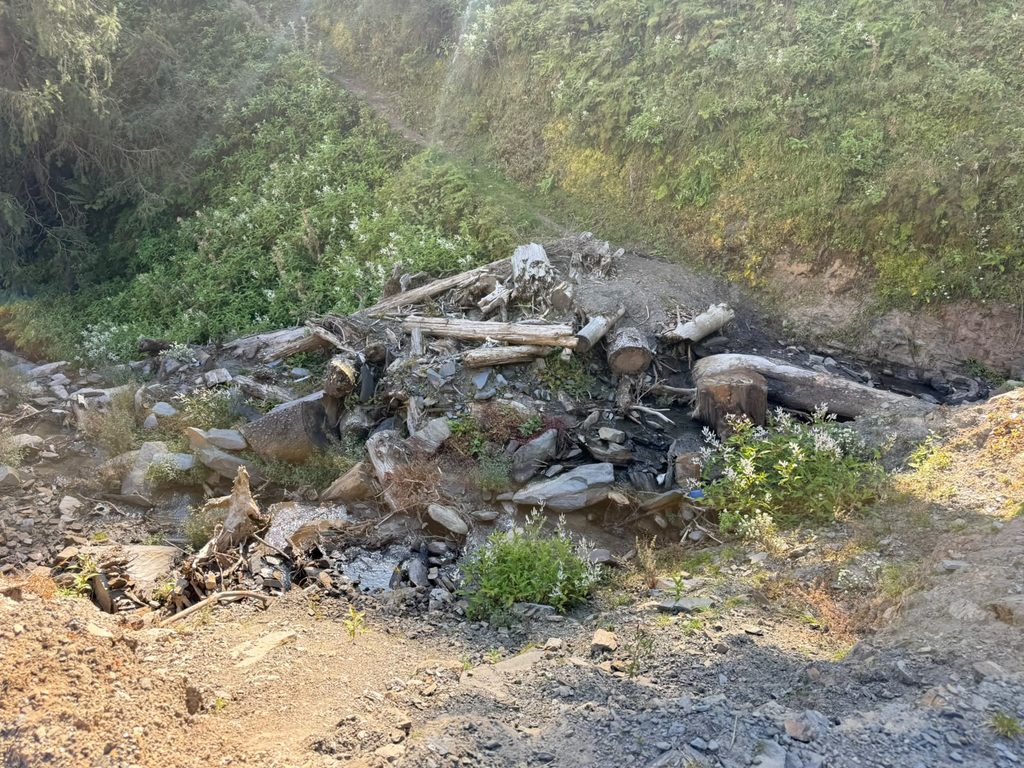
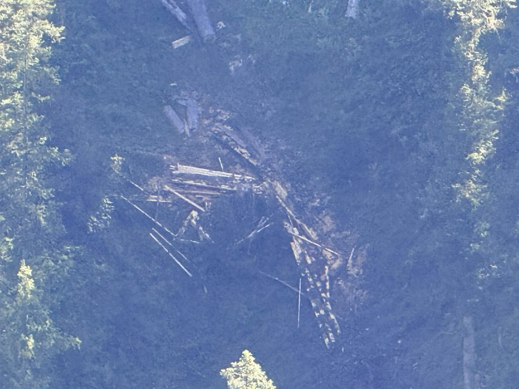
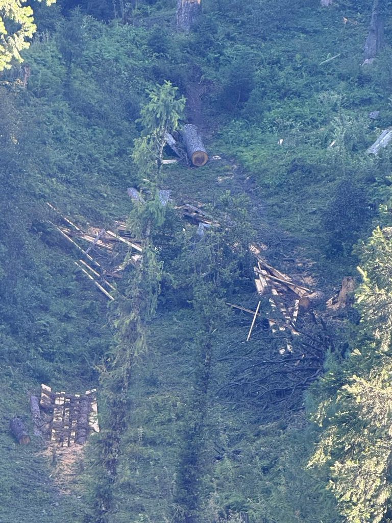
Several photographs show large sections of cut tree trunks lying among rocks, soil and vegetation within narrow drainage channels.
The images reveal accumulations of logs and wood fragments at different points along the drainage areas. Some larger trunk sections have clearly visible cut surfaces, while smaller pieces of wood are scattered nearby.
These observations document the physical presence of cut timber within the photographed forest environment.
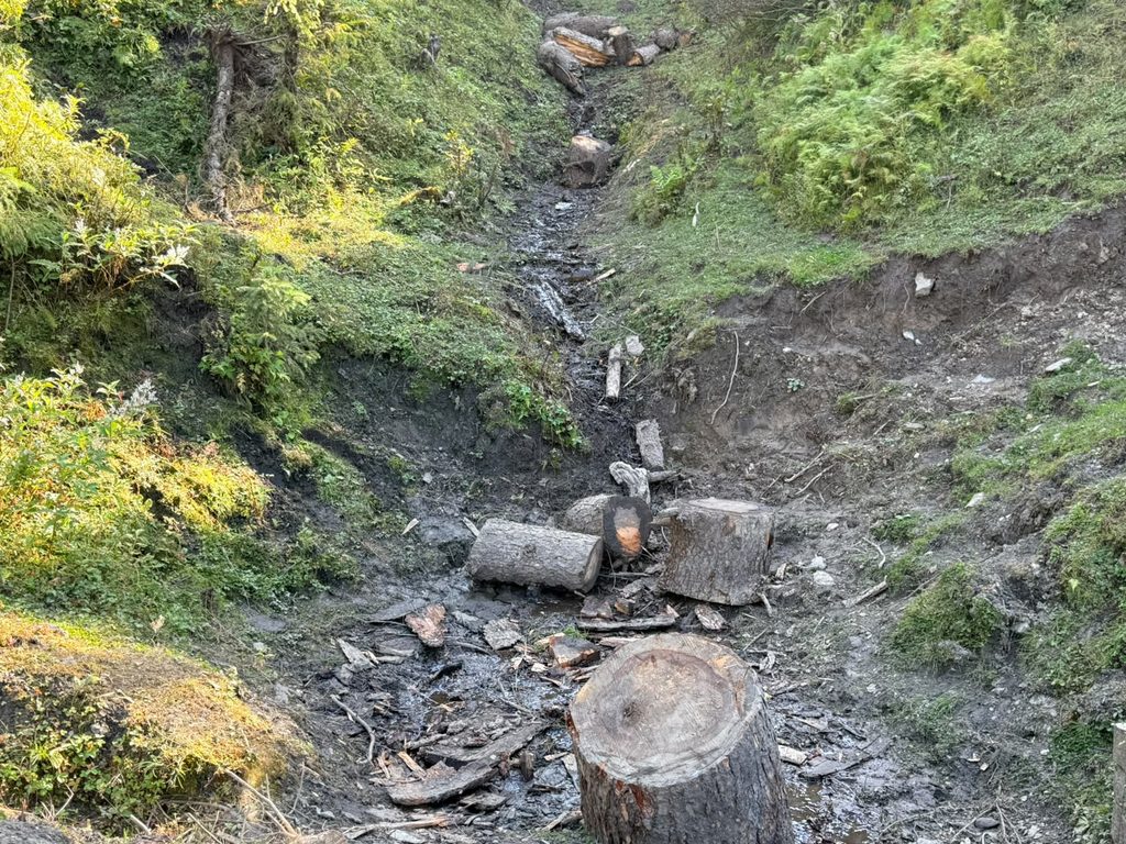
Additional photographs show timber and wood fragments visible on forested slopes, including material lying among trees and surrounding vegetation.
Stacked Timber in a Forest Clearing
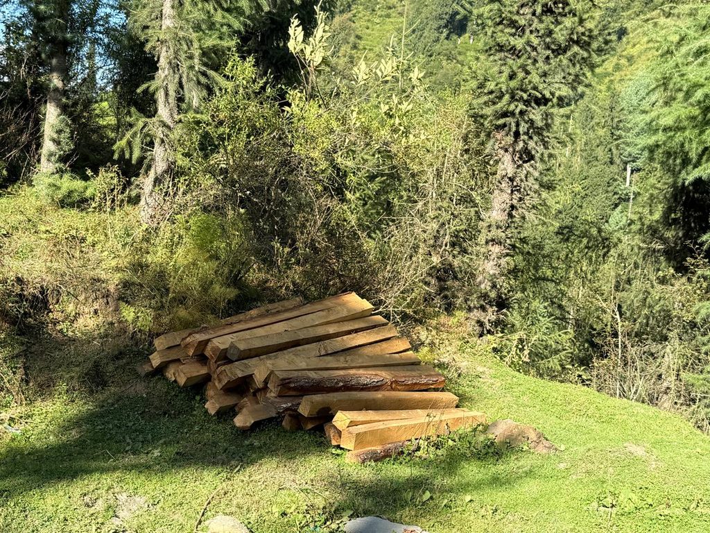
Another set of photographs shows rectangular sections of processed timber stacked together in a clearing surrounded by trees.
One photograph carries a GPS Map Camera overlay identifying Mandi, Himachal Pradesh, with coordinates 31.526719° N, 77.287335° E and a displayed date of 24 September 2026.
The printed coordinates fall within the geographical boundaries identified in the satellite assessment. The images document the presence of processed timber, although they do not establish its source, ownership or whether its extraction was authorised.
Understanding the Evidence of Forest Disturbance
The satellite assessment and photographs provide two forms of visual documentation.
The satellite comparisons identify changes in vegetation cover and disturbed land between 2015 and 2026. The accompanying photographs document cut logs, timber accumulation and processed wood within forested surroundings.
Together, these materials raise concerns about possible logging-related forest disturbance. However, they do not independently establish the causes of every observed change, the origin of all photographed timber, or whether the cutting and movement of wood were authorised.
The assessment’s findings therefore require careful interpretation. Establishing the precise extent, cause and circumstances of the vegetation loss would require additional verification beyond the supplied imagery and photographs.
Protecting Himachal Pradesh’s Forest Ecosystems
The changes documented in the assessment highlight the importance of understanding how forest landscapes are changing over time.
Vegetation loss and increasing areas of exposed ground are important environmental observations, particularly in forested mountain regions where natural ecosystems depend on the relationships between trees, soil, water and surrounding habitats.
Careful documentation of such changes, supported by reliable geographical evidence and field observations, is essential for understanding potential threats to forest ecosystems.
The available material provides a basis for further examination of the identified locations while reinforcing the need for accurate, responsible reporting and continued attention to the protection of Himachal Pradesh’s forests.
Related Articles
More stories and updates worth exploring from our journey.