PSPK Seeks Independent Scrutiny of Mineral Extraction Across Sirmaur Rivers

We submitted a representation by email to the Chief Justice of the Himachal Pradesh High Court on 8 November 2026, seeking independent scrutiny of mineral extraction and stone-crushing activity across the Yamuna, Giri and Batta river systems in Sirmaur district. Our concerns are supported by preliminary geographic mapping, satellite observations and field photographs, but the legality and environmental compliance of individual operations remain subject to official verification.
A Representation Concerning 3 River Systems
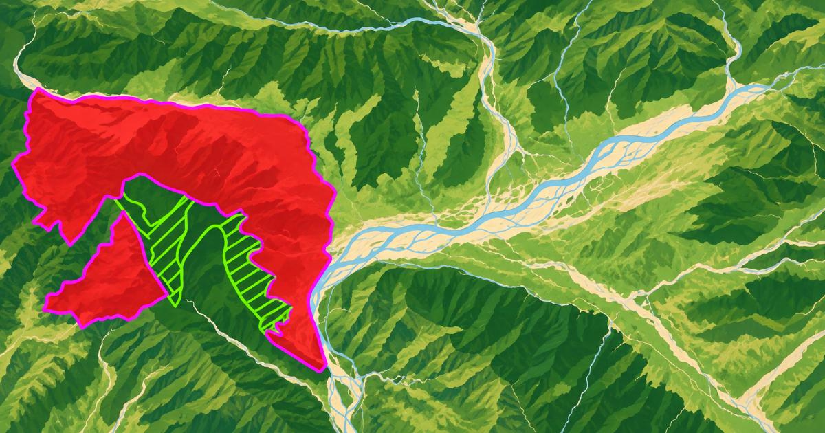
Our representation draws attention to the apparent concentration and longstanding presence of mineral extraction and processing infrastructure across the three river systems. The most detailed geographic observations concern an approximately 16-kilometre stretch of the Yamuna corridor near Paonta Sahib, where numerous locations associated with possible stone-crushing and mineral-processing activity have been marked for further investigation.
The preliminary examination suggests that some stone-crushing infrastructure may have existed for three to four years, possibly longer, while riverbed extraction may have a more extended history. These estimates have not been confirmed through official records. The commencement dates, permitted extraction quantities, operating histories and authorisations require verification.
Through our representation, we requested that the matter be considered under the applicable Public Interest Litigation Rules, 2010. We also sought an independent, time-bound scientific examination, supported by geographic information system (GIS) mapping, to establish the actual scale of extraction, authorised mineral-processing capacity, and cumulative environmental impacts.
Preliminary Mapping Identifies 49 Crusher-Labelled Locations
Our Google Earth-based investigation identifies 49 crusher-labelled geographic points and 12 user-drawn suspected riverbed-extraction areas across separate geographic sectors.
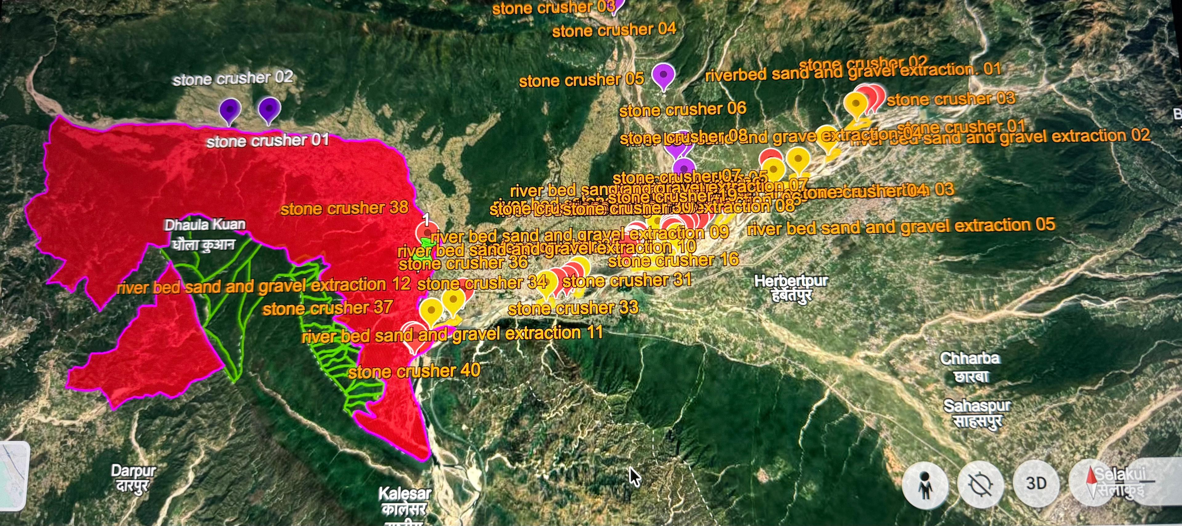
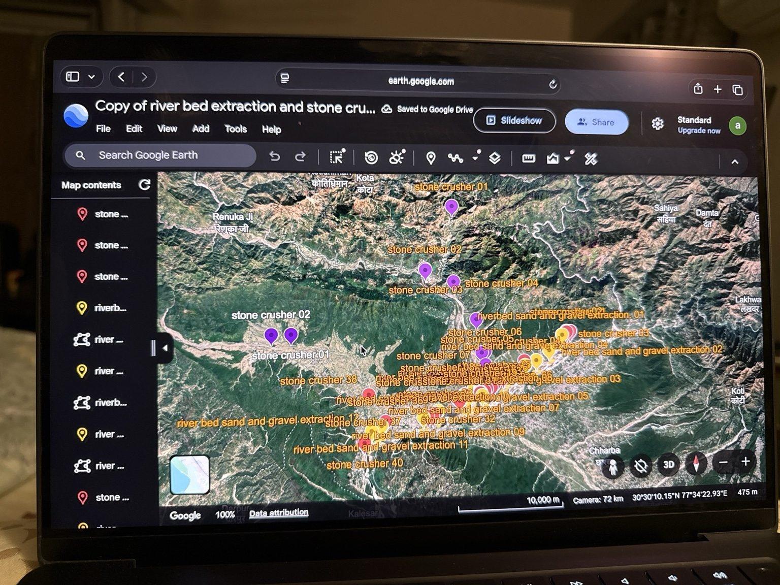
The mapping provides a geographic basis for examining how multiple possible extraction and processing locations relate to river corridors, settlements and the surrounding Shivalik landscape.
However, mapped locations must be compared with authenticated mining-lease boundaries, approved site plans, environmental clearances and other government records before firm conclusions can be drawn about individual operations.
Satellite Imagery Raises Questions About Riverbed Disturbance
The satellite observations include areas near the Yamuna where processing yards, vehicle tracks and structures resembling conveyors or other mineral-handling equipment are visible. Other views show disturbed riverbed surfaces and networks of tracks.
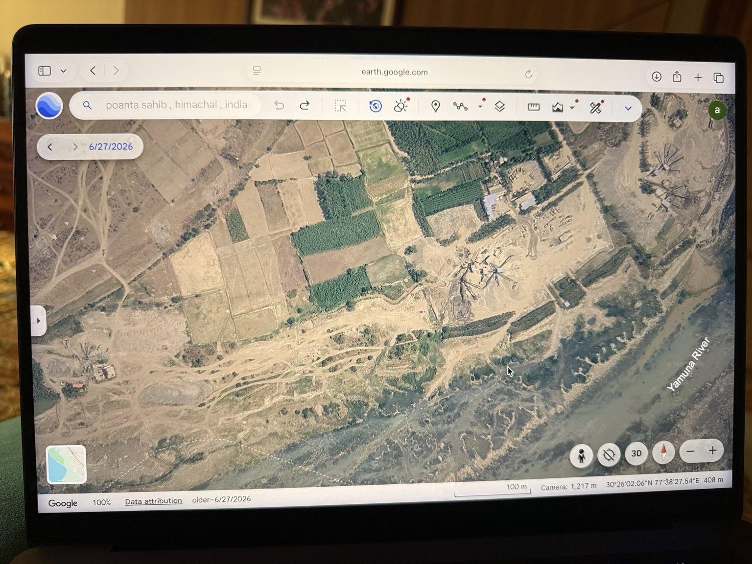
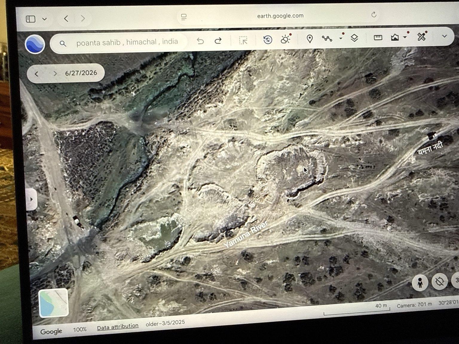
These observations warrant closer examination, but satellite imagery alone cannot determine the nature, duration or legal status of an industrial activity. The historical imagery dates also require authentication against the original image metadata.
The environmental questions extend beyond the appearance of individual sites. Our representation asks whether the combined scale of mineral extraction and processing across the river systems has been examined in relation to sediment replenishment, river morphology, groundwater, floodplain stability and biodiversity.
These are matters requiring scientific investigation rather than conclusions that can be established from photographs alone.
Field Photographs from Tokion and Dhaula Kuan
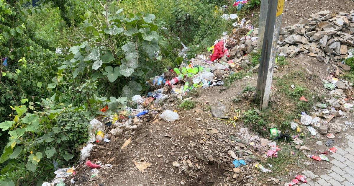
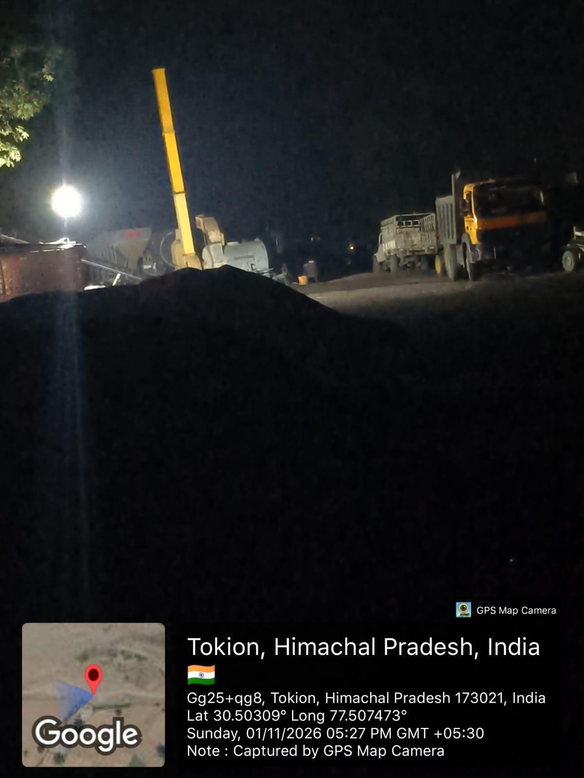
Our investigation also includes geotagged photographs recorded on 1 November 2026 in the Tokion and Dhaula Kuan areas.
A photograph labelled Tokion, timestamped 5:27 p.m., shows illuminated equipment, material piles and heavy vehicles at a site. The GPS Map Camera overlay records coordinates of 30.503090° N and 77.507473° E.
The High Court's April 2026 Judgment on the Eco-Sensitive Zone
An important legal development affecting the surrounding landscape was the Himachal Pradesh High Court's judgment of 16 April 2026 in Gram Panchayat Bhatanwali & Ors. versus Union of India & Ors., CWP No. 9434 of 2025.
The case concerned the Eco-Sensitive Zone (ESZ) notification issued on 13 January 2022 around Col. Sher Jung National Park, formerly known as Simbalbara National Park. An ESZ is intended to regulate activities around protected areas to reduce environmental impacts on surrounding ecosystems.
The High Court examined whether the prescribed procedure had been followed before the notification was issued. It found that an earlier proposal had lapsed and that the subsequent notification process had proceeded without the required fresh assessment and stakeholder involvement.
The judgment recorded that 19 villages had been included in the notification without the prescribed survey and inventory of land-use patterns, industrial activities and important ecological corridors. It also found that the required committee process had not been undertaken after the earlier proposal lapsed.
The Court concluded that the mandatory procedure had not been followed and quashed the notification dated 13 January 2022, issued as S.O. 172(E). The ruling addressed the validity of that notification. It did not determine the legality of any specific stone crusher or riverbed-extraction site identified in our subsequent investigation. Nor should the quashing of the ESZ notification be treated, by itself, as proof that every industrial activity in the surrounding area has all necessary permissions.
Departmental Correspondence Following the Judgment
Documents issued by the Himachal Pradesh Department of Industries and the Wildlife Division show how the judgment subsequently became relevant to the registration status of a particular stone-crushing unit.
In correspondence dated 25 April 2026, the Geological Wing referred to a stone crusher at Mohal Puruwala Santoshgarh, Tehsil Paonta Sahib, whose permanent registration had previously been held in abeyance under an order dated 11 September 2025. The correspondence sought comments on a request to restore that registration following the High Court judgment.
A Wildlife Division communication dated 28 April 2026 stated the department's position concerning the effect of the judgment on the earlier ESZ notification and directed that comments be sought from the Divisional Forest Officer, Paonta Sahib, whose jurisdiction covered the area.
A separate Department of Industries order dated 28 April 2026 revoked the earlier order holding the unit's permanent registration in abeyance, with immediate effect. This correspondence records an administrative decision concerning one identified unit. It does not establish the registration status, environmental compliance or operating permissions of the other locations identified in our mapping.
RTI Correspondence Shows That Key Records Are Held by Different Offices
Further information was received through a Right to Information response dated 10 November 2026, issued by the Wildlife Division, Shimla. The RTI request sought records concerning directions issued after the High Court judgment, mining and stone-crushing activities within 10 kilometres of the national park boundary, relevant wildlife approvals, inspections, protected-area mapping and wildlife-monitoring information.
The response enclosed departmental correspondence relating to the judgment and subsequent communications. For several requests concerning mining projects, stone crushers, approvals and inspection records, the Wildlife Division indicated that the matters pertained to the Divisional Forest Officers at Nahan and Paonta Sahib.
For information concerning the preparation or re-notification of the Eco-Sensitive Zone, the response referred to the Principal Chief Conservator of Forests (Wildlife) and the Conservator of Forests, Nahan.
It also stated that a KML file showing the national park boundary had been sent by email on 10 November 2026. A KML file contains geographic information that can be displayed in mapping software and can assist with boundary comparisons.
The response referred separately to wildlife-monitoring records under Annexure III. Those records require examination before conclusions can be drawn about the documented presence or movement of wildlife in the area.
The division of records among different government offices reinforces the need for a consolidated examination rather than treating any single departmental reply as a complete account of mining permissions and environmental compliance.
What Independent Verification Must Establish
Our representation seeks a scientific and records-based assessment of the relationship between mineral extraction, industrial processing and the ecological condition of these river systems.
The principal information requiring verification includes the following.
- Mining and processing authorisations. The locations and boundaries of mining leases, environmental clearances, pollution-control permissions and authorised stone-crushing installations.
- Extraction and transportation records. Permitted mineral quantities, actual extraction returns, processing capacity and authenticated mineral dispatch records.
- Sediment replenishment and river conditions. Scientific assessments of riverbed replenishment and the implications of cumulative extraction for river morphology, groundwater and floodplain stability.
- Protected-area and wildlife considerations. Authenticated national park boundaries, applicable wildlife approvals, recorded animal movement and relevant ecological corridors.
- Cumulative environmental impacts. Whether the combined activities across the Yamuna, Giri and Batta systems have been evaluated in relation to the ecological sustainability of the wider landscape.
The central question is not simply whether individual installations possess particular permissions. It is also whether the combined scale and duration of extraction and mineral processing have been assessed against the capacity of these river systems to replenish sediment and maintain their ecological functions.
We have therefore sought an independent examination capable of bringing together official permissions, geographic evidence, extraction records and scientific findings.
Our representation does not allege that every mapped installation operates unlawfully or falls within a notified protected area. The 49 crusher-labelled points and 12 suspected extraction areas remain preliminary geographic observations.
The purpose of placing these concerns before the High Court is to seek consideration of a transparent, evidence-based examination of mineral extraction across Sirmaur's river systems. Such scrutiny would help establish the facts, distinguish authorised operations from any potential violations and provide a sound basis for protecting the ecological integrity of the Yamuna, Giri, Batta and surrounding Shivalik landscape.
Related Articles
More stories and updates worth exploring from our journey.