The Arithmetic of a Normal Year: How Vulnerable Is Himachal Pradesh?

Himachal Pradesh has just experienced a normal monsoon. Rainfall remained within the India Meteorological Department’s normal band, without a cloudburst catastrophe or red alerts. Yet rain triggered disasters have already claimed 107 lives and caused losses exceeding Rs 1,202 crore. That, more than the rainfall itself, is a measure of the state’s vulnerability.
A Normal Monsoon, an Abnormal Cost
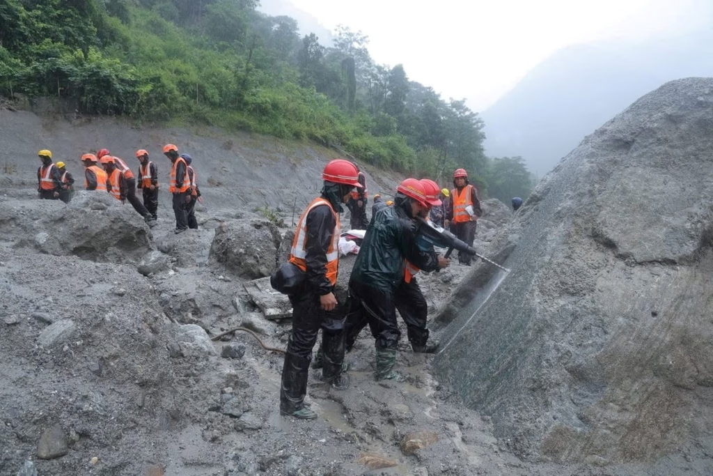
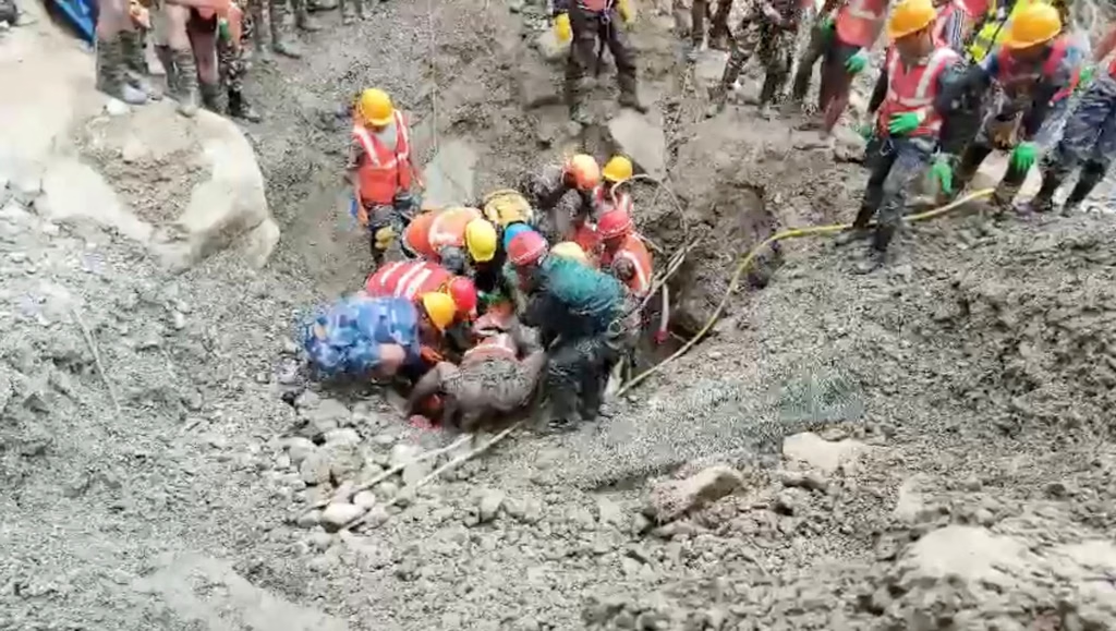
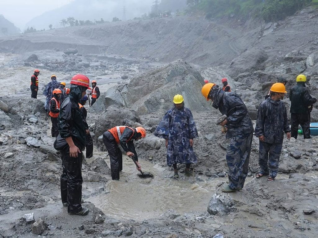
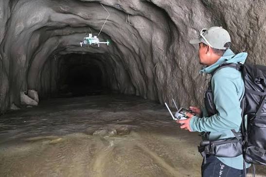
On August 29, the South Asia Network on Dams, Rivers and People published an account of the disaster three days earlier in Nepal’s Trishuli and Bhote Koshi valleys, where more than 1,900 people went missing. Some 900 of them were from hydropower project sites, while workers were trapped inside tunnels at projects financed by some of the world’s largest development banks.
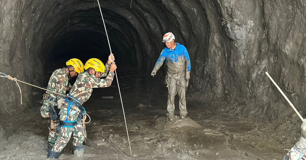
Read from Shimla, it raises a question that is not really about Nepal: what stands between Himachal Pradesh and the same page of newsprint?
The answer begins with our own arithmetic.
Between June 1 and August 31, Himachal Pradesh received about 10 per cent less rain than normal. This does not amount to a drought or even a deficit season. The India Meteorological Department classifies rainfall between minus 19 and plus 19 per cent of normal as normal. Himachal did not appear among the fourteen states listed as rainfall deficient in late August.
Nationally, India stood at minus 13 per cent, a larger shortfall than Himachal.
The month by month record was also unremarkable. The monsoon arrived late on June 30, leaving the month 33 per cent short of normal rainfall. July recorded an 8 per cent surplus, while August ended 16 per cent below normal.
The location of the shortfall is important. Much of it was concentrated in the cold desert, where absolute rainfall is low to begin with. Lahaul and Spiti was around 60 per cent below normal for the season, while Kinnaur was 58 per cent short in August.
The populated and landslide prone mid hills, however, were at or above normal. Kullu and Shimla were both about 14 per cent above normal for the season, while Sirmaur was 19 per cent above normal in August.
The districts that suffered damage were not short of rain.
As of September 2, the State Emergency Operations Centre had recorded 261 deaths during the season. Of these, 107 were caused by rain triggered disasters, while 154 occurred in road accidents. Total losses were recorded at Rs 1,202.64 crore, including Rs 914.76 crore attributed to the Public Works Department alone.
The season was still not over. A routine spell of rain at the beginning of September, accompanied only by yellow warnings, left 150 roads out of service on September 2. Of these, 78 were in Mandi and 30 in Shimla. The same spell disrupted 374 transformers.
The comparison with previous years is revealing.
The 2025 monsoon season ended with 454 deaths and losses of Rs 4,881 crore. That year recorded 47 cloudbursts, 98 flash floods and 148 major landslides, with rainfall 39 per cent above normal, the highest in 29 years. On September 4, 2025, 1,350 roads and five national highways were blocked simultaneously.
The 2023 disaster caused losses estimated at Rs 8,679 crore in the state’s September tally and around Rs 12,000 crore in the state’s broader estimate of public and private losses. Against the state’s formal claim, the Centre initially released Rs 633.73 crore, or 6.4 per cent of the amount claimed.
The 2026 season is far lighter than 2025. That is precisely the point.
Himachal lost Rs 1,151 crore in 2021 and Rs 939 crore in 2022. A largely unremarkable monsoon in 2026 has already exceeded both figures, with part of the season still remaining.
The damage cannot be explained by extraordinary weather alone. We have created a landscape in which ordinary rainfall can cause extraordinary damage.
Five areas of decision making help explain how we reached this point.
Roads: Cut Vertical, Dumped Downhill
Himachal Pradesh has 2,592 km of national highway across 25 highways. Another 69 highways have been approved in principle, covering a further 4,312 km. Much of this consists of reclassified state roads that are now expected to meet national highway geometry on Himalayan slopes.
The exposure to landslides is well documented.
A 2015 landslide hazard assessment for the Revenue Department’s disaster management cell found that 60 per cent of the state’s road network lay in landslide vulnerable terrain. This included 993 km of the then 1,628 km of national highway classified in the high vulnerability zone.
The state’s post monsoon inventory for 2023, published by the State Centre on Climate Change, mapped 13,569 landslides. Kangra accounted for 4,027, Mandi 2,169, Solan 1,930 and Sirmaur 1,395.
The method of road construction has added to this exposure.
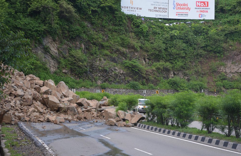
On the Parwanoo-Solan four laning project, slopes were excavated vertically to heights of 20 and 30 metres. Engineering assessments of Himachal’s slopes place stable excavation angles between 48 and 75 degrees.
The Public Works Minister has stated: “Due to vertical cutting of hill slopes, boulders and debris roll down during the rainy season.”
The Parwanoo-Solan corridor recorded 113 landslides within 55 days during the 2023 monsoon. Slope retrofitting is now under way at 42 critical sites on the Parwanoo-Solan section and another 28 on the Solan-Kaithlighat section.
The Kiratpur-Manali highway’s cost has risen from Rs 1,818 crore to roughly Rs 6,000 crore, driven largely by destruction of infrastructure that had already been constructed.
Muck disposal presents another problem.
A 2017 CAG report found that only three of 20 approved dumping sites were operational. In CWPIL No. 31 of 2023, decided in May 2024, the Himachal Pradesh High Court recorded the National Highways Authority of India’s own admission that, of 6,41,256 cubic metres of excavated muck, 2,34,080 cubic metres had been dumped on private land.
The Forest Department has fined NHAI Rs 1.15 crore for illegal dumping on the Ramshila-Manali stretch alone. A contractor fined Rs 85.87 lakh by the Pollution Control Board had paid Rs 29.25 lakh a year later.
The state has also claimed Rs 658 crore from NHAI for the drowning of the 126 MW Larji powerhouse, alleging that the double decker road narrowed the Beas by four metres. The state says it raised the concern in 2019 and received no response.
The evidence is not uniform. An NGT joint committee that inspected the Kiratpur-Nerchowk section in 2024 found no unauthorised hill cutting or illegal mining there.
But the overall scale of road damage remains significant. In 2025, 10,642 km of Himachal’s 39,102 km non national highway road network was severely damaged. Fourteen bridges were washed away, and Rs 3,010 crore was required for restoration.
There is also a less visible problem beneath the highway network. A total of 2,183 roads in Himachal stand built in violation of the Forest (Conservation) Act, 1980. These include 821 in Mandi, 613 in Shimla, 495 in Kangra and 254 in Hamirpur.
The state’s announced response in 2025 was to seek their regularisation.
Hydropower and an Increasingly Fragile Landscape
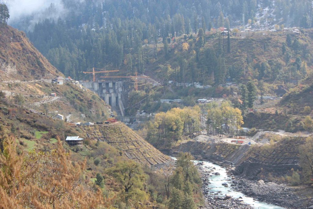
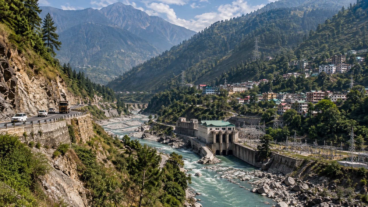
Himachal Pradesh’s assessed hydropower potential is estimated at 27,436 MW. Around 10,281 MW has been commissioned across 29 large projects.
Large hydropower projects are visible and frequently debated. Smaller projects receive much less attention.
HIMURJA’s published list of small hydro projects of up to 5 MW includes 595 projects, of which 109 have been commissioned. In July 2025, the state scrapped 194 stalled projects. Another 15 were scrapped in March 2026. In April 2026, 71 of the same sites were advertised again.
The environmental footprint per unit of electricity also deserves attention.
A cumulative assessment of the Beas found that small and medium run of river projects divert 0.267 km of river per MW, compared with 0.033 km per MW for large projects. This means roughly eight times more river length is diverted for each unit of power produced.
On the Satluj, once the planned cascade is complete, more than 90 per cent of the river is expected to be either tunnelled or impounded, with about 185 km of tunnel.
In August 2025, the Supreme Court observed that “the mighty trans-Himalayan river Sutlej stands reduced to a rivulet” and found that developers were not maintaining the mandated minimum flow.
Hydropower projects are also becoming victims of the same unstable conditions.
Between July 25 and August 1, 2024, 14 hydropower projects were damaged and rendered non operational. At least eight workers died at Sumez.
In June 2025, flooding disabled all four turbines at the 800 MW Parbati-II project and buried the trash racks of Parbati-III. At the 4.8 MW Indira Priyadarshini project in Kangra, seven workers were killed in a powerhouse built inside a flood zone.
Malana-I has been hit by flash floods on August 1 in three consecutive years.
A landslide dammed lake on the Jiva nullah, formed in 2023 and only partially cleared in early 2026, remains about three kilometres upstream of Parbati-III.
Above this infrastructure are 2,292 glacial lakes in the Sutlej basin. Around 1,335 of them are inside Tibet and therefore beyond monitoring controlled by Himachal Pradesh.
The State Centre on Climate Change has identified 67 lakes larger than 10 hectares. The National Disaster Management Authority has classified four as high risk, including Baspa in Sangla.
Early warning systems are under development at four sites, but officials have cited lack of network connectivity as a constraint.
Mining: Pressure on the Riverbed
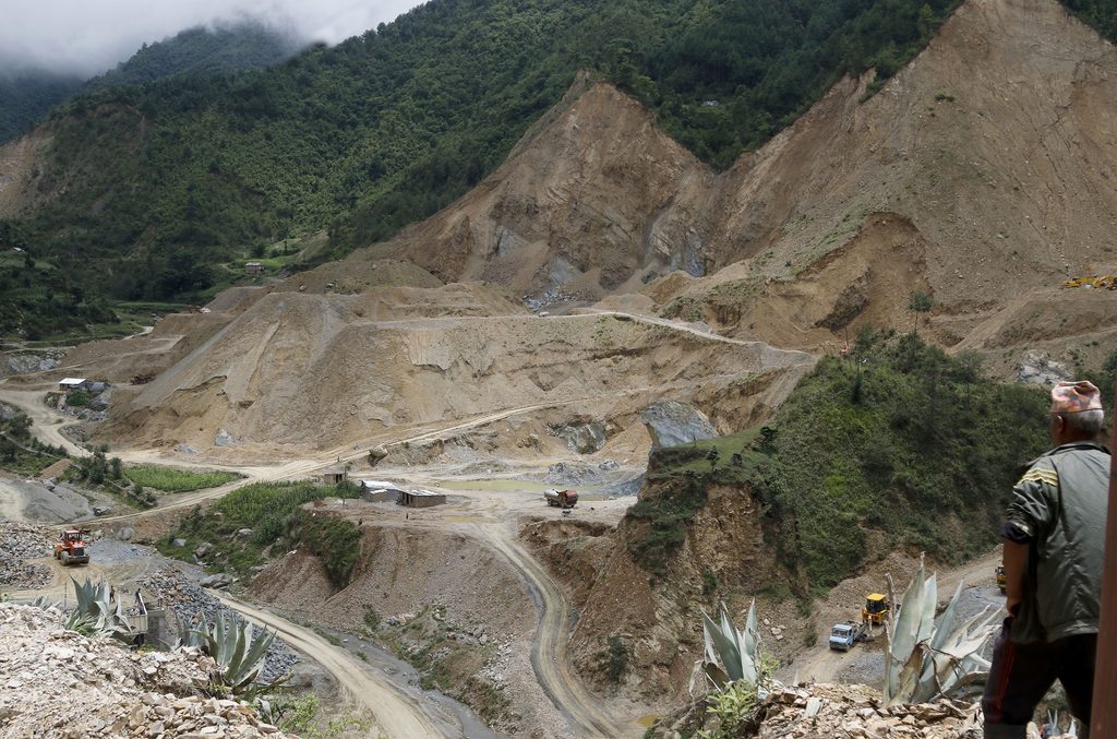
Himachal Pradesh has 448 registered stone crushers and 551 mining leases.
Between 2022-23 and 2024-25, the state registered 29,276 illegal mining cases and collected Rs 18.33 crore. That represents roughly 27 cases every day, with an average recovery of around Rs 6,000 per case.
At such levels, enforcement risks becoming a cost of operation rather than a meaningful deterrent.
The Mineral Policy 2024 doubled the permitted depth of riverbed excavation from one metre to two metres.
The consequences for surrounding structures have been documented at several locations.
At Kala Amb in Sirmaur, mining has eroded bridge foundations on the Markanda by approximately 40 feet.
On the Chakki, ravines up to 100 feet deep developed below a railway bridge that collapsed in August 2022. Around a hundred crushers operated on that riverbed. The Railways said it had repeatedly raised concerns about mining damage, while district administrations maintained that the bridge had collapsed because of its age.
In the Beas basin, 68 of 131 crushers lacked the necessary permissions. In August 2023, the state shut 129 of roughly 300 active crushers in the basin, with the Chief Minister citing “an alarming transformation of the ecosystem.”
Sirmaur illustrates the gap that can emerge between official documentation and conditions reported on the ground.
The District Survey Report of 2024, which forms part of the basis for environmental clearances in the district, states that “no change in river profile is noticed in the past few years” and that the flood season completely refills excavated pits.
However, the report contains no data row for the Markanda.
In May 2025, the National Green Tribunal took up a complaint from Salani Katola panchayat in Nahan tehsil alleging that around 250 acres of irrigated land were turning barren as the water table fell beside a crusher.
The Khads: Where Is the Regulatory Line?
One of the most important regulatory gaps concerns construction near nallahs, khads and rivers.
The Himachal Pradesh Town and Country Planning Rules, 2014 contain no statewide minimum setback from a nallah, khad or river.
Rule 15 requires a site plan to show the nallah, but does not prescribe a minimum distance that construction must maintain from it. Setback provisions exist only in area specific development plan regulations covering part of the state.
Himachal Pradesh has also not enacted floodplain zoning legislation. When the Union government listed states that had enacted such legislation, Himachal was absent, even though the same table identified 2.87 million hectares as flood prone area in the state.
More than 80 per cent of Himachal is rural and historically remained outside the Town and Country Planning Act. The threshold has only recently been lowered so that construction above 1,000 square metres in rural areas requires approval.
The post disaster needs assessment following the 2023 disaster stated that building bye laws “are not mandatory” in rural areas outside planning limits and noted an “absence of building permit systems in most rural areas.”
The consequences can be measured.
At Thunag on the night of June 30, 2025, Mandi received 140.7 mm of rain in 24 hours, 1,939 per cent above normal. Forty eight houses were destroyed and 73 shops were wiped out.
A study by Himachal Pradesh University’s Centre for Disaster Risk Reduction and Resilience, published in August 2026, found that encroachment on the active floodplain predicted damage better than building quality. Satellite imagery showed progressive loss of riparian buffers and narrowing of the channel. Neighbouring areas that experienced comparable rainfall suffered considerably less damage.
There have been announcements proposing setbacks of 100 metres from rivers for houses and 150 metres for government buildings, as well as model rural bye laws cleared in September 2025.
What remains absent is a notified line, a demarcated floodplain and even a reliable count of structures exposed to these zones.
There is no official estimate of how many structures stand within Himachal’s flood prone areas. There are, however, more than 25,000 unauthorised structures statewide, and seven retention policies have been extended to such structures.
The High Court has said this sequence “only embolden the violators.”
The Growing Pressure on the High Ground
In 2025, Himachal Pradesh recorded 3.11 crore tourist arrivals against a resident population of about 75 lakh. Tourism accounted for 7.77 per cent of state GSDP.
The arrivals figure requires an important caveat. Of the total, 1.66 crore was counted as religious tourism, and the increase from 1.80 crore in 2024 almost certainly reflects a change in what is being counted.
Vehicle numbers provide a clearer indication of physical pressure.
Between May 1 and June 15, 2026, more than 15 lakh vehicles entered Shimla, equivalent to around 33,000 vehicles a day.
This traffic entered a city where 90 per cent of core area construction is located on slopes steeper than 60 degrees. Parts of the core have densities of 2,500 to 3,500 persons per hectare, compared with a recommended hill settlement density of 450.
Shimla’s water demand of 47 to 48 MLD has been met by a supply of 33 MLD.
The Atal Tunnel was designed for 4,500 vehicles a day, but has carried between 7,500 and 10,000 vehicles during peak 24 hour periods. This prompted the Deputy Commissioner of Lahaul and Spiti to formally seek a safety audit. Carbon deposits are also accumulating on the tunnel walls.
Manali’s waste generation more than doubles during the tourist season, from 30 tonnes to 70 tonnes a day.
Across the state, 20 urban local bodies have no sewage facility at all.
The regulatory history of Shimla shows the difficulty of reconciling construction, tourism and carrying capacity.
In 2017, the National Green Tribunal held that Shimla had “far exceeded its carrying capacity.” It capped building storeys, prohibited new construction in the core and 17 green belts, and prohibited development on slopes above 40 degrees.
Development Plan 2041 subsequently restored construction in core areas, increased non core permissions to three storeys and an attic, and allowed one storey in green belts.
The Supreme Court upheld the plan in January 2024, finding that it contained “sufficient safeguards.”
A later notification permitting buildings of up to 20 storeys in central business districts was stayed by the High Court.
At the same time, 28 ropeway projects have been approved across Himachal Pradesh. Seven of them, worth Rs 3,232 crore under Parvatmala, include routes to Bijli Mahadev, Shikari Devi, Kheerganga and Hamta.
The state also has 4,289 registered homestays, with an estimated 3,000 more operating without registration.
Where carrying capacity has actually been calculated, the figures are significant. In October 2025, the NGT capped Kufri at 2,232 tourists a day and 293 horses on a trail that had previously been carrying 700 to 800 horses.
What These Five Areas Have in Common
The central problem is not a lack of knowledge.
The Geological Survey of India has mapped Himachal’s susceptibility to landslides. The state ranks second in India, with 26 per cent of its area in the high susceptibility category. The figure rises to 42.86 per cent in Chamba and 39.93 per cent in Kinnaur.
The State Centre on Climate Change has counted the landslides.
The CAG has examined dumping sites.
The NDMA has identified high risk glacial lakes.
District survey reports, development plans and cumulative impact assessments already exist.
What is missing is a clear regulatory line: a notified floodplain, a statutory setback from a khad, a carrying capacity determined before investment rather than after disaster, and a slope angle that operates as a rule rather than a preference.
In August 2026, the Himachal Pradesh High Court, acting on its own motion, suspended pending forest clearances for new roads and tarring to Chandertal, Shikari Devi and Churdhar. The court found that road permissions were opening ecologically sensitive areas to greater tourist pressure.
It is the right instinct. Too often, however, such intervention comes after the road has already been cut.
Nepal’s August disaster will be studied for what its financiers knew.
Himachal’s position is simpler.
We know. We have written it down. We are still building.
Related Articles
More stories and updates worth exploring from our journey.